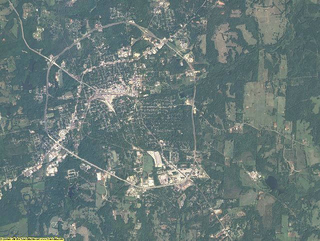
Generic Sample of 2 meter color imagery from Anderson County, TX
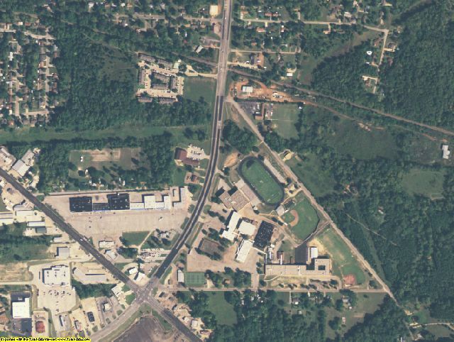
2 meter imagery zoomed in. This shows the level of detail you will get for your entire county.
See samples from other locations: Airport Stadium School City Farm Farm zoomed in
2005 Aerial Photography CD of Jefferson County, OH Product Information
Info for the GIS professional:
Date = 2005 spring/summerCoverage = All of Jefferson County, OhioProjection = UTMResolution = 2 meter color ortho-rectified imageryFormat = MrSIDCompatible = all ESRI products, (ArcGIS, ArcView, ArcInfo, ArcMap, ArcPAD etc.), Erdas, MapInfo, ERMapper, AutoCAD any other GIS software that reads MrSID formatDelivery = FTP or CD/DVDNo restrictions of use. Commercial use is allowed
Info for Novice user:
Free GIS viewer software -Windows 98/2000/NT/XP/Vista/Win7. MAC users must run under windows dual boot.Easy to use - No experience neededPrint aerial photos at any scale on your own printer, even large postersPan and zoom in/outMeasure distances/areasRead UTM map coordinatesAdjust brightness/contrastExport image to JPEG, TIFF, PDF, etc.100% coverage for your County2 Meter Pixel Resolution - See above sample2005 Aerial Photography taken in the spring/summerDelivery = CD/DVDNo restrictions of use. Commercial use is allowed. Use in publications, websites, & maps/posters. You get full utility of the data - not just a jpg snapshot! Our competitors license their imagery and state "You may not use the imagery in any commercial or business environment or for any commercial or business purposes for yourself or any third parties."
Interested in USGS Topographic Maps also?
Jefferson County, OH USGS Topo Map CD for $14.99
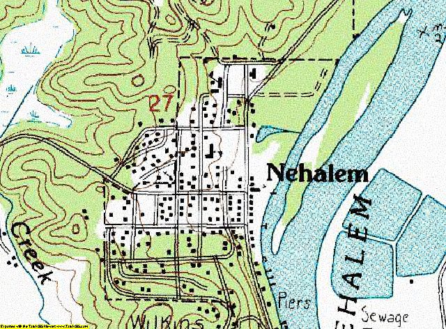
USGS TOPO CDs of your County!
All the USGS 1:24,000 scale quadrangle maps for your County have been merged together to create this seamless map.
Same great format for the GIS professional MrSID UTM NAD83
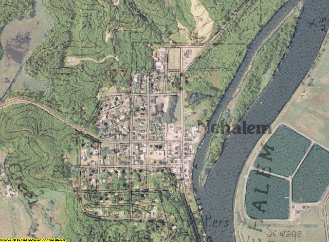
Aerial Photography overlayed with USGS topographic map
You must purchase both USGS TOPO CD and AERIAL PHOTO CD for your county in order to do this.
Larger sample of Aerial with TOPO - PDF export from program (2 megabyte) .
Here are instructions for making the Aerial with TOPO overlay map

