Instructions for making the Aerial with TOPO overlay Map
Open Aerial Photography
Double click on your YourCountyName.sid file to open the TatukGIS viewer
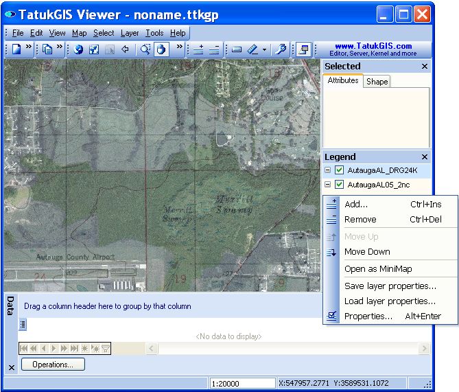
Right click inside legend on right side of screen - select ADD
Navigate to c:\TopoMap and select YourCountyName_DRG24K.sid (this may be in c:\AirPhoto is you bought Aerial & Topo together)
Double click on YourCountyName_DRG24K.sid in the legend to bring up the properties box
In the properties box, select Layers, then type 25 for the Transparency value - Select OK
On the top bar menu, Select Map >> Map Units >> set to Meter
The TOPO map is readable between 1:8000 and 1:30,000.
I have right clicked in the legend to show the ADD button. Note that the DRG24K file is on top of the aerial file.
Add the USGS Topo Map
Set the USGS Topo Map to transparent
Set The map Units
Zoom to your area of interest.
Here is what it should look like.